New wildfires started by lightning in West amid historic heatwave, Tropics turn active with 3 new systems
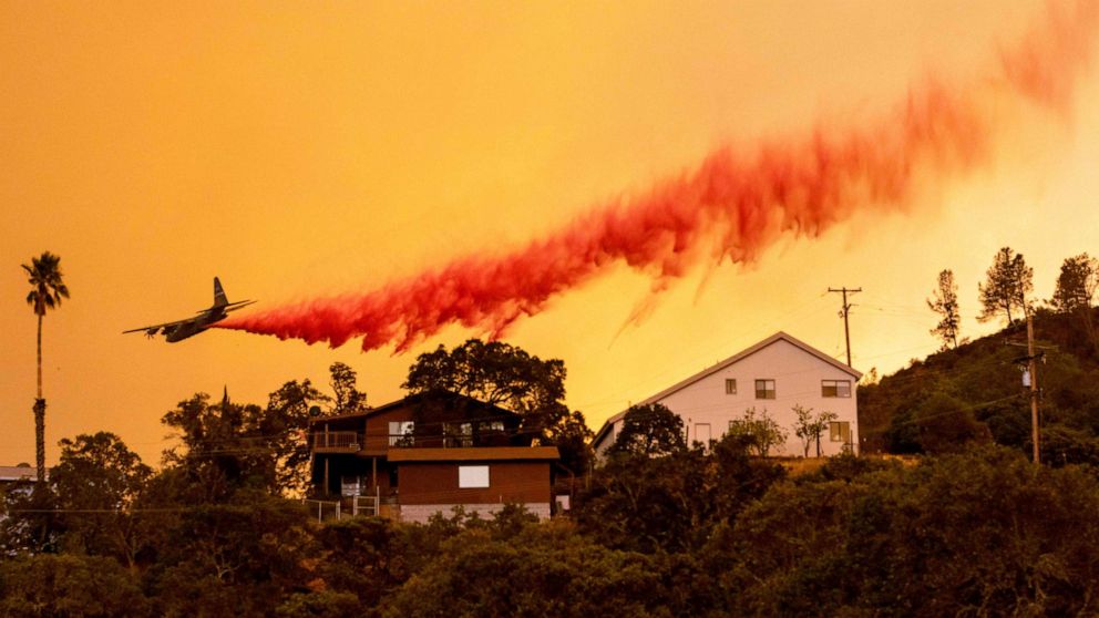
More wildfires have exploded in the West, particularly in California, due to numerous lightning strikes.
At least 26 wildfire complexes burning in California and some of these fire complexes contain several smaller fires.
Here is the latest on the recent fires in California.
The LNU Lightning Complex fire in Sonoma and Napa Counties is 32,025 acres and 0% contained. Three structures have been destroyed with 1,900 more threatened and evacuations are in effect.
The SCU Lightning Complex fire in Santa Clara, Alameda, Contra Costa, San Joaquin and Stanislaus Counties is made up of approximately 20 different fires, is 35,000 acres and is 4% contained with 1,200 structures threatened and evacuations in place.
The CZU August Lightnight Complex fire in San Mateo and Santa Cruz Counties is 7,500 acres and currently 0% contained. It is made up of multiple large lightning-caused fires and mandatory evacuations in place with 1,200 structures threatened.
The Holser fire in Ventura County is 3,000 acres and is now 20% contained. If the fire holds through the night then all evacuation warnings would be lifted.
The Loyalton fire is 44,147 and 30% contained with five homes and six buildings destroyed and mandatory evacuations remain in effect.
More fires are burning in Colorado where the Pine Gulch fire is now 87,770 acres and is the third largest fire in Colorado history.
The Grizzly Creek fire is now 27,269 acres and Interstate 70 continues to be closed for the second week in a row because of it.
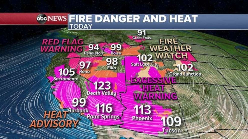
In addition to all the fires burning in the West, historic heat is also gripping this part of the country.
Some of the heat record include Anaheim, California which reached 105 degress, which is the hottest temperature ever recorded there in August.
Elsewhere, Denver hit 100 degrees for the first time this year, another record fell in Phoenix at 115, Salt Lake City peaked at 101, Cedar City, Utah reached 100 degrees for the third straight day which has never happened in August before, and a record high was broken in Burbank, California at 109 degrees.

The bad news continues in the West as Red Flag Warnings have been issued for more dry lightning and erratic winds from thunderstorms.
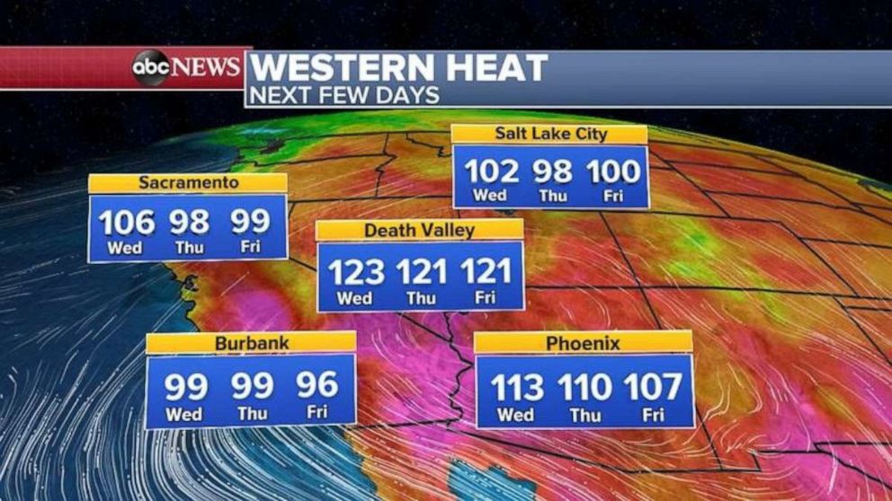
Heat Warnings and Advisories remain today and more record highs are possible today in the West, including another triple-digit reading in Salt Lake City.
There is no major relief from the heat forecast, only a slight drop in some of the record heat, but readings will still will be close to 100 degrees for most in the West for the next few days.

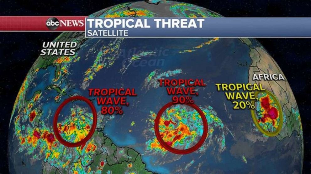
Elsewhere, it is becoming very active out in the Atlantic Ocean as three tropical waves stretching from Africa all the way to Caribbean are all lined up and forecast to possibly develop into tropical depressions or storms in the next few days.
The tropical wave that is the closest to U.S. is located in the Caribbean Sea and has an 80% chance to develop into a tropical depression or a storm in the next few days.
The computer models take this system over the Yucatan Peninsula and into the Gulf of Mexico by early next week although it is too early to say how strong it will be by the time it gets into the Gulf.

The second tropical wave is still in the middle of Atlantic Ocean and has a 90% chance for development into a tropical depression or a storm.
The computer models take this system near Puerto Rico by this weekend and into the Bahamas and possibly Florida early next week! It is too early to say how strong it will be when it gets to Florida and the U.S.
Finally, there is now a third tropical wave we are monitoring that is about to come off the African coast.
It is way too early to say if this one will reach the United States but the peak of hurricane season is coming in the next several weeks and Sept. 10 is the climatological peak of Atlantic hurricane season.


