Tropical Storm Isaias strengthens into hurricane, lashes Puerto Rico, targets US East Coast
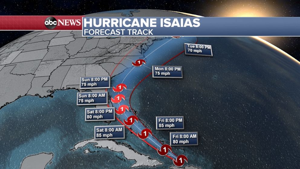
Isaias has strengthened from a tropical storm into a Category 1 hurricane, the National Hurricane Center announced Thursday night, adding that the storm's maximum winds are estimated to be 80 mph, with higher gusts.
The government of the Bahamas has issued a Hurricane Warning for the central and southeastern Bahamas.
A special advisory will be issued soon.
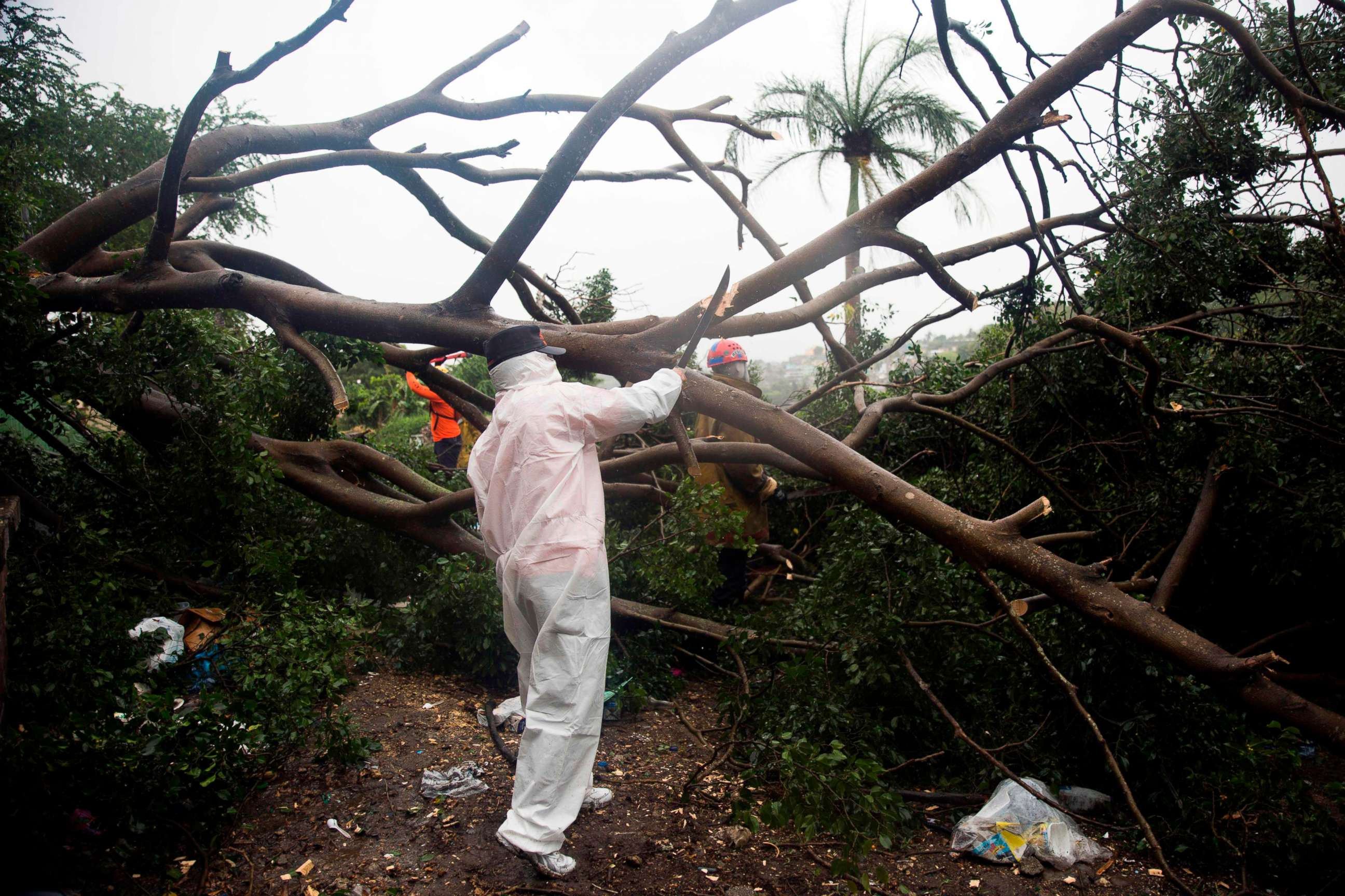
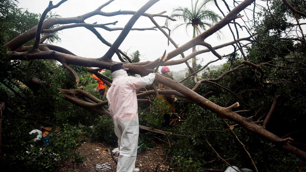
The storm continues its path through the Caribbean leaving intense flooding in Puerto Rico.
Multiple municipalities on the west and east side of the island have been hit the hardest by the storm.
On the west side of the island at least 41 people have been rescued amid the flooding, Puerto Rico National Guard Gen. Jose Reyes told ABC News.
Officials are still visiting affected areas in the island as intense showers continue Thursday evening.
A woman's car was swept away by water in Rincón, on the west side of the U.S. territory. The head of the island’s Emergency Management Service confirmed at a press conference that they are still looking for her, though her car has been found.
Heavy rain and intense flooding have led to destruction in communities that were already vulnerable due to the earthquakes.
About 400,000 families are without power and at least 150,000 are without water.

The island's power authority executive director, Jose Ortiz, said most customers should have power "within today or tomorrow."
As the island is facing multiple emergencies, Reyes told ABC News that one of his main worries is how they've had to stretch their resources.
"It's concerning when you have a certain number of resources and you have two, three and four battles to fight" Reyes said. Amid the storm, Puerto Rico is still trying to recover from Hurricane Maria and ongoing earthquakes while fighting the COVID-19 pandemic.
There are currently 22 shelters opened with over 60 people -- following social distancing guidelines.

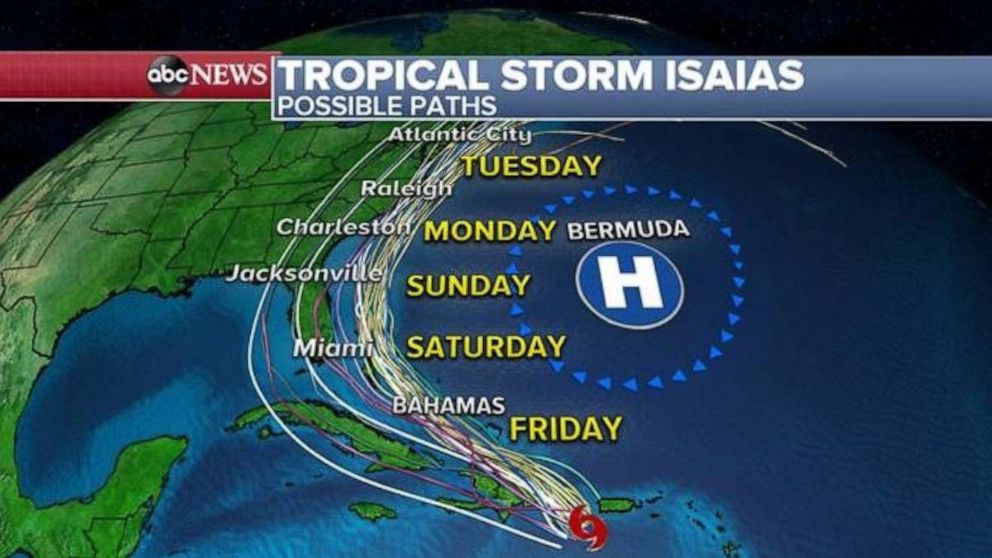
Tropical Storm Isaias has now reached Dominican Republic, as it continues its path toward the East Coast of the U.S.
Isaias will likely be near the Turks and Caicos Islands and southern Bahamas on Friday.
Some fluctuation in intensity is expected as the storm interacts with the more mountainous terrain if Hispaniola.
If the storm can maintain its organization and some intensity past Hispaniola, there will be some opportunity for strengthening on Friday and Saturday as the storm moves through the warm waters near the Bahamas and east of Florida.
Isaias will bring tropical storm force winds of over 50 mph to Puerto Rico, Dominican Republic, Haiti and the Turks and Caicos Islands.
Locally 4 to 8 inches of rainfall is expected across these Caribbean Islands, which could cause flash flooding and mudslides.

Over the last 24 hours, some of the model consensus has shifted eastward as the track has shifted eastward. Once the storm passes Hispaniola, there will be a better understanding of how this storm will behave as it moves towards the United States.
If the storm manages to stay east of Florida and avoid a tremendous amount of land interaction, conditions may be conducive for some strengthening off the Southeast coast line.
Water temperatures are very warm along nearly the entire U.S. East Coast and that will help the storm maintain intensity or gain strength slightly.
This is reflected in the official forecast track. The cone of uncertainty includes the possibility of the storm staying just offshore and traveling along the East Coast into early next week.
If this happens, there could be some impacts to the Georgia, the Carolinas and perhaps the Mid-Atlantic and into part of the Northeast.
Regardless of the exact forecast track, impacts from Isaias remain quite possible along the East Coast even though the exact location and magnitude of the these impacts remains uncertain.


