The Technology Behind the Search for the Vanished Malaysia Airlines Plane
March 23, 2014— -- As the search for the missing Malaysian Airlines Flight MH370 drags into its third week, officials are using advanced technology to look for any sign of the plane.
Follow All the Latest News on Vanished Flight MH370
Satellites, special buoys and a virtual fleet of ships and planes are headed to the search area off the coast of Australia. While officials are hopeful to find a sign of the plane, with more than a hundred thousand square miles of ocean to cover, it could take time for even the most advanced technology to find the disappeared plane.
The "Sub Hunting" Planes
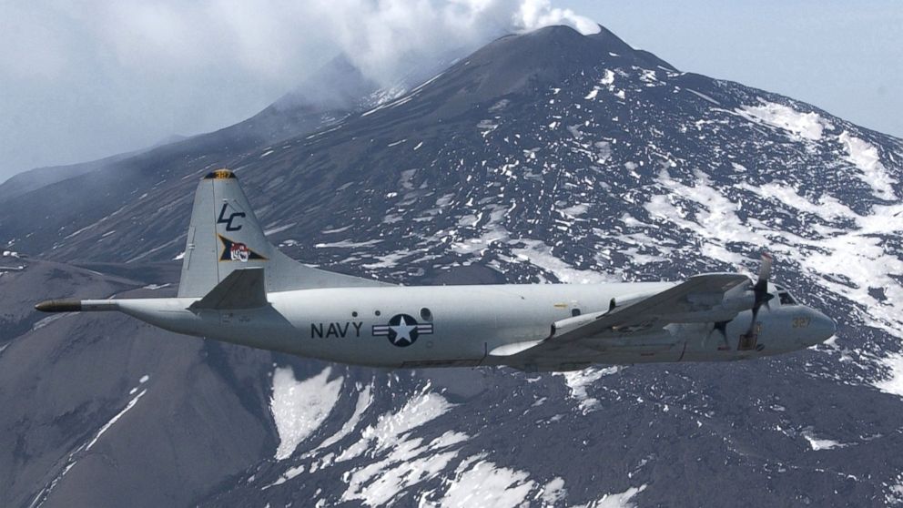
Some of the most useful tools in the search for the Malaysia Airlines flight are military planes designed to search below the ocean's surface.
Both P-3 Orion and P8 Poseidon planes are being used in the search.
The P-3 Orion model was originally known as a "sub hunter" for its ability to find submarines under water. It is equipped with sensitive sensors including digital multi-mode radar, electronic support measures, electro-optics detectors (infra-red and visual), magnetic anomaly detectors and acoustic detectors designed to find anything unusual on either an ocean's surface or deep underwater.
The U.S. has also sent a P-8 Poseidon plane, which has similar capabilities as the P-3 but are designed for longer-range missions allowing them more time to search before they have to refuel.
The HMAS Success
In addition to the planes, a virtual flotilla of ships from multiple countries are heading towards the search area approximately 1,500 miles from Perth, Australia.
The Australian Navy announced Saturday that the HMAS Success arrived. The ship is the largest ever built for the Australian Navy and will be able to recover any plane debris found in the water.
The British ship HMS Echo, a hydrographic survey ship for the Royal British Navy, was supposed to help with the search but officials told ABC News that the ship had yet to leave the Persian Gulf. It will take at least 10 days before it can reach the search area.
Current Tracking Buoys
After Australian military satellites spotted two mysterious objects near the designated search area of the coast of Australia, the Australian air force started to drop special buoys in the water to try and find the object by tracking currents.
By tracking currents the specially designed buoys may help searchers deduce where the objects seen on the satellite ended up. If wreckage is found on the ocean surface, investigators may be able to find the crash site by figuring out how far the debris traveled through currents.
Satellites
Satellites hundreds miles above the earth have helped lead to the first possible clue to the plane's disappearance in weeks. Earlier this week Australian officials announced two mysterious objects in the water, which be connected to the plane. Ships and planes were sent to scour the area.
How Satellite Images Could Reveal What Happened to Flight MH 370
The company Digital Globe announced that it was its WorldView-2 satellite that captured the image. That satellite is suspended 770 kilometers above the earth's surface and can cover up to 1 million square kilometers per day.
While the initial object found by the satellite has not been found, China announced Saturday their satellite found a similar object in the vicinity.
Human Eyes
In spite of all the technology available to the searchers, Australia announced they are primarily using human spotters to look for possible clues or debris from Flight MH 370. Officials said human spotters would be slower than radar but likely yield better results.
The Associated Press contributed to this report.


