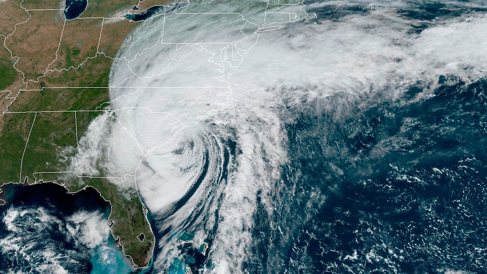
Hurricane Ian tracker: Latest maps, projections and possible paths as storm hits South Carolina
After making landfall for the fourth time, Hurricane Ian has been downgraded to a post-tropical cyclone.
Ian has sustained winds of 70 mph and the "dangerous storm surge, flash flooding and high wind threat continues," the National Hurricane Center said in its latest bulletin. The storm is not expected to strengthen now that it is over land.
After delivering a devastating impact to southwestern Florida and western Cuba earlier in the week, Ian made landfall as a Category 1 hurricane at 2:05 p.m. ET Friday near Georgetown, South Carolina, with sustained winds of 85 mph, according to the National Hurricane Center.


Ian first made landfall in Cuba as a Category 3 storm early Tuesday, hitting the island's western end.
After traveling through the Gulf of Mexico, it made landfall again along the southwestern coast of Florida Wednesday afternoon as a Category 4 storm, the National Hurricane Center said. Landfall was near Cayo Costa, an island off the coast of Fort Myers.
It then made landfall on mainland Florida, just south of Punta Gorda, with the deadly storm then traveling through central Florida.
After being downgraded to a tropical storm briefly, Ian strengthened back to a Category 1 hurricane as it traveled off the east coast of Florida and into the warm waters of the Atlantic Ocean toward the Carolinas.

Ian is expected to rapidly weaken as it heads inland to the north, though will bring the threat of heavy rain and flooding to the mid-Atlantic.
A flood watch is in effect for a large portion of the Carolinas into the Mid-Atlantic, even as far inland as West Virginia.
Southwest Florida saw catastrophic storm surge from Wednesday's landfall, and life-threatening storm surge remains a risk as Ian moves north. Charleston, South Carolina, could see storm surge of at least 7 feet high.
Reported rainfall has topped a foot in numerous communities in central Florida, with some seeing as much as 2 feet. Flooding remains a risk as Ian moves north, with up to 12 inches forecast from Charleston to the North Carolina border.
Up to 6 inches is also possible in parts of the Carolinas.


Some of the heavy rain will come up to Philadelphia and the New York City area by Saturday morning, with 2 to 3 inches of rain possible locally.
Gusty winds are expected as well.
Tornadoes are also possible due to Ian. A tornado watch is in effect from Myrtle Beach, South Carolina, to Virginia Beach, Virginia, through 10 p.m. Friday.
ABC News' Dan Amarante and Melissa Griffin contributed to this report.


