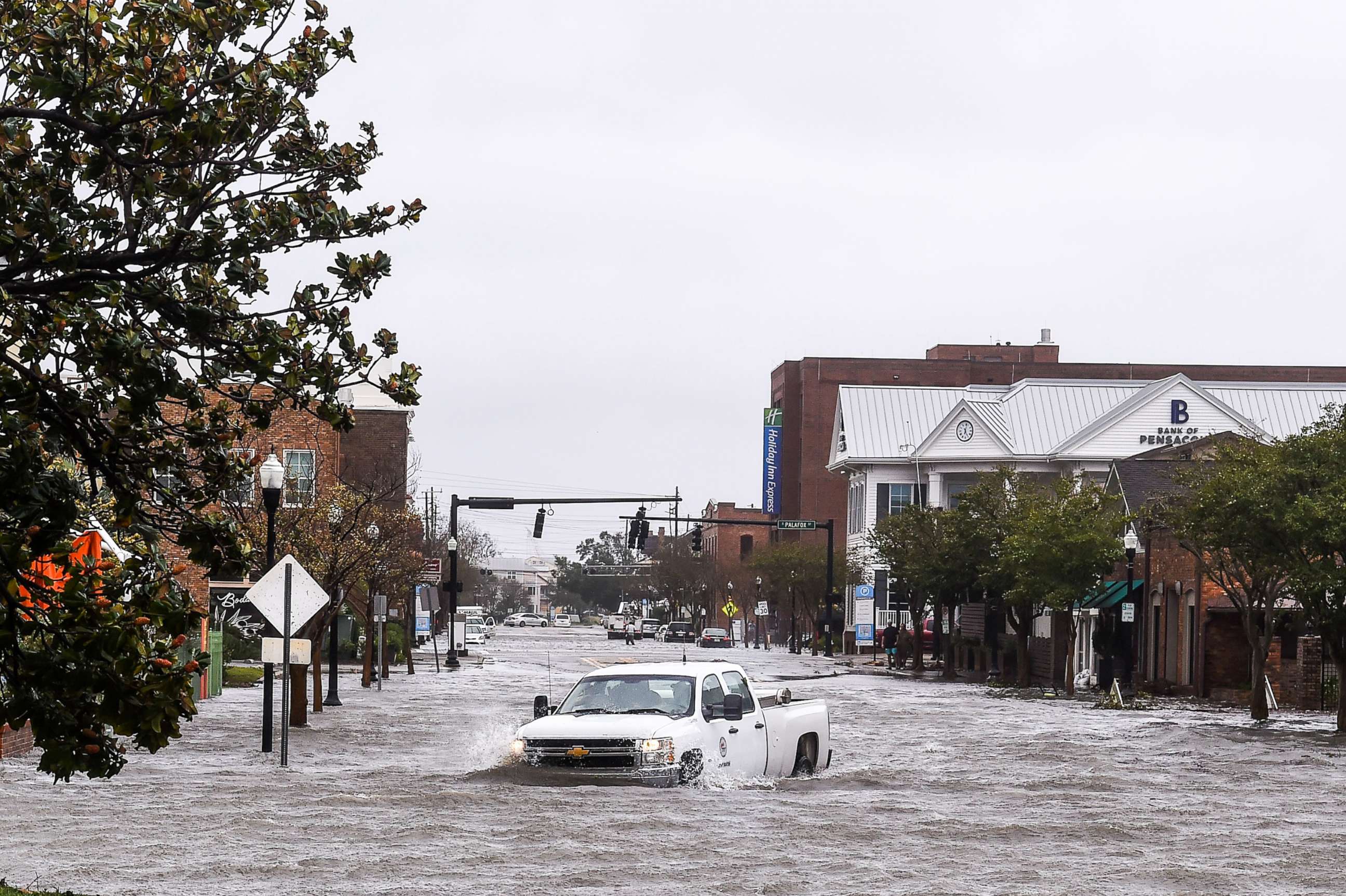
Hurricane Ian: Why the Gulf Coast -- especially in Florida -- is so vulnerable to hurricanes, storm surge
The more than 1,200 miles of shores in the southern U.S. that line the Gulf of Mexico are no stranger to strong storms -- but that doesn't make potential damage from an approaching cyclone any less likely.
As Hurricane Ian marches closer to the U.S., its aim toward the Gulf Coast is especially concerning considering how vulnerable the region is to storm surge, experts told ABC News.
The underwater geology of the Gulf of Mexico is what makes the Gulf Coast particularly unguarded against the massive influx of seawater. The shallow waters in the Gulf, combined with the symmetry of its shallow ocean floor, are what allow the storm surge to be pushed even higher onto land, Ryan Truchelut, chief meteorologist at Weather Tiger, a consulting and risk management firm, told ABC News.

The continental shelf of the Florida Gulf Coast extends quite far offshore -- up to 200 miles in some spots, Truchelut said.
"The waters of the Gulf of Mexico just simply aren't that deep, over a lot of the Florida coastal waters just offshore," he said. "If there's wind pushing water toward that direction, it's shallow, it has nowhere to go. So it kind of amplifies and goes further inland."
Meteorologists are most concerned about the west coast of Florida, starting in the Florida Keys and north to Tampa Bay, Michael Brennan, acting deputy director for the National Hurricane Center, told ABC News.
The Tampa Bay area is "extremely sensitive" to storm surge, Brennan said, adding that the region could experience 5 to 8 feet of inundation -- meaning above ground-level flooding. The Fort Meyers and Charlotte Harbor areas could see 4 to 7 feet and regions farther south could see 3 to 5 feet of inundation, Brennan said.

Another reason why the Gulf of Mexico is especially vulnerable to hurricanes and storm surge is because of its unique U-shaped coastline, which essentially traps a storm system into a populated region, no matter which way it turns, Truchelut said.
"When a hurricane gets into the Gulf of Mexico, it's hard for it not to hit somebody," he said.
The same geography conundrum also applies on a smaller scale to Tampa Bay, which is almost shaped like a cul-de-sac and doesn't have anywhere for the water that's getting pushed around to go, Truchelut said.
"Right now, the way this storm is coming in, you'd have this sort of push of surge right into Tampa Bay and in regions along the Gulf, western Gulf Coast," Marshall Shepherd, director of the Atmospheric Sciences Program at the University of Georgia and former president of the American Meteorological Society, told ABC News.

Although the models are still uncertain, Ian will almost certainly strike somewhere along the eastern Gulf Coast as a major hurricane, Shepherd said.
Oftentimes, if a hurricane trapped within the Gulf of Mexico changes directions, it exacerbates the threat even more, Truchelut said. The change in direction typically slows down the storm system, allowing more time for waves to get bigger and head toward the shallow continental shelf, he added. Ian will likely stall over the Tampa Bay region, Shepherd said.

Ian does not even need to directly impact the Tampa Bay region to do considerable damage, the experts said. Even without a direct hit, the slow movement at Ian's intensity will bring intense storm surge, flooding rain and prolonged hurricane-force winds.
In November 2020, Tropical Storm Eta, which had downgraded to a weak tropical storm after making landfall in Central America as a Category 4 hurricane, caused widespread flooding in Tampa. The storm made direct impact about 90 miles north of Tampa, but the 70 mph winds and soaking rain still caused bay waters to top seawalls in the area.
"It'd be 1,000 times worse had it been an actual major hurricane that was well organized," Truchelut said.

Because of the way Ian is moving, as well as its intensity and the fact that it may stall, it places the Tampa Bay region on what meteorologists call "the dirty side of the hurricane" -- the right front quadrant of the storm, just to the right of the eye, that typically has the worst of the winds and storm surge due to the motion and circulation of the system, Shepherd said.
A large concern is that many of the areas that flooded in the Tampa Bay region more than 100 years ago will do so again and at a greater scale -- and this time, populated by hundreds of thousands more people from the influx of development that has occurred since, Truchelut said. Much of the coastal infrastructure, including condos and homes along the coast, did not exist the last time a major hurricane directly impacted the region, Shepherd said.
Climate Central, a nonprofit news organization that analyzes and reports on climate science, has calculated the 100-year flood height in the Tampa Bay area at 6.5 feet. There are more than 125,000 homes in the region currently situated below that flood level.

The experts cautioned residents in Florida to heed evacuation warnings and not to be deterred by the category of the storm or "hurricane amnesia," since it has been a century since the region experienced a major storm.
"We as a society have to get accustomed to or used to planning for the worst, and maybe it doesn't happen," Shepherd said. "As good as our weather predictive capability is, if not, it still has some uncertainty with it."
ABC News' Max Golembo contributed to this report.


