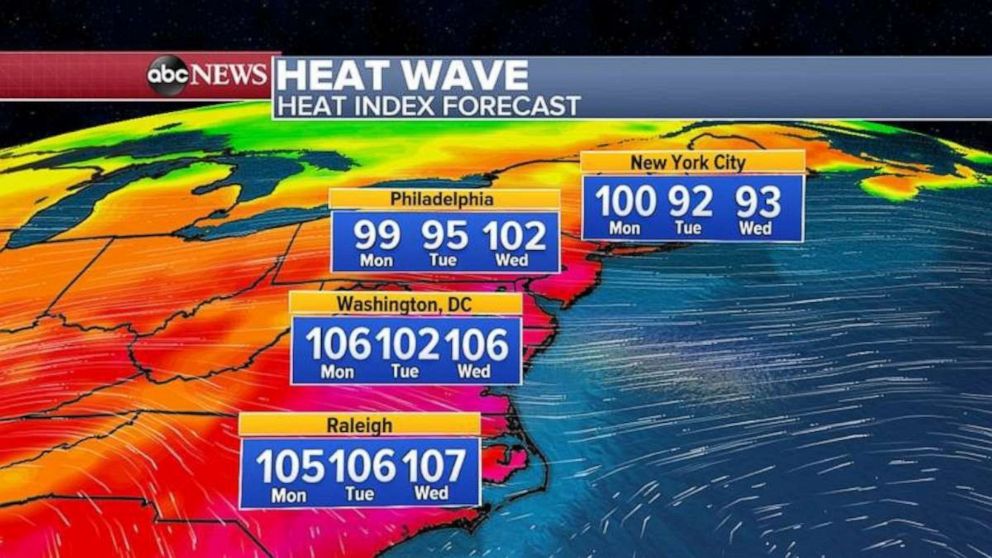
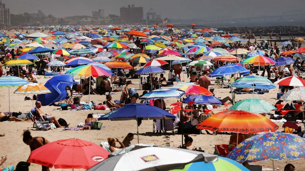
Heat wave in Northeast and the East Coast bringing record temperatures
A heat wave continues to affect the Northeast with more than a dozen record highs tied or broken yesterday from New Hampshire down to Virginia.
Some of the records from yesterday include Richmond, Virginia which reached 101 degrees, Washington, D.C.’s Dulles Airport tied its record at 98, Norfolk, Virginia hit 102 and Manchester, New Hampshire, peaked at 98 degrees.
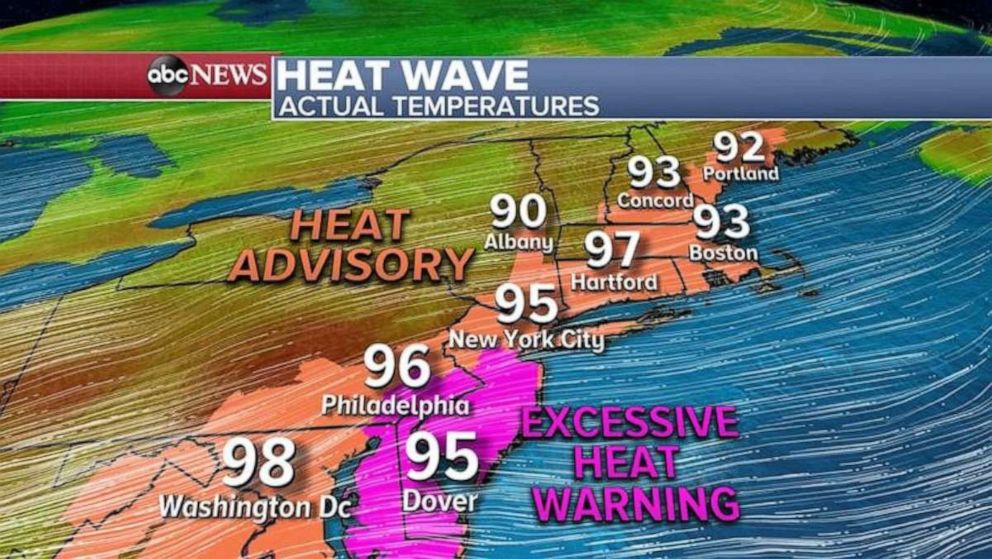
More records are possible today with 15 states from South Carolina to Maine under Heat Advisory and Warnings.
Temperatures are expected to reach the 90s with near 100 possible from Hartford to Washington, D.C.
Record highs will also be possible in Hartford which is forecast to be 97 and has a record of 100 along with Baltimore which is forecast to be near 100 and the record there is 102.
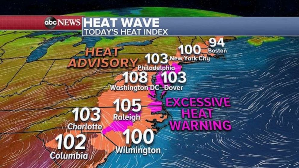
But as they always say, it’s not the heat it’s the humidity. So today will feel like its 100 to 110 degrees from New York City to Washington, D.C. and all the way down to the Carolinas.
Additionally, because of the ongoing heat wave in the Northeast, where in some parts of southern and central New Jersey it will feel like its near 114 degrees, the Philadelphia Department of Public Health has declared a Heat Health Emergency beginning Monday morning.
The big question is how long will this sauna type of weather last? Will we see any relief?
There is a weak cold front that is expected to move through the Northeast on Tuesday and some drop in humidity should occur for New England down to New York City and Philadelphia, but down in D.C. and the Carolinas the scorcher is expected to continue.
More substantial cooling and drier air is expected in the Northeast and Mid-Atlantic by the end of the week, however. Summer is now half way over and the meteorological fall begins September 1, just a little more than a month away.
