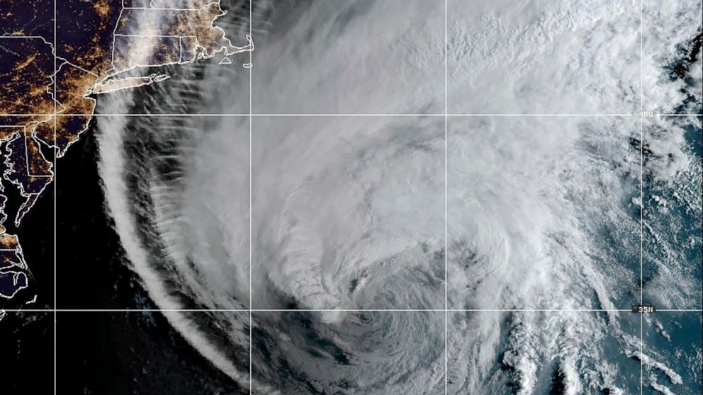
Lee made landfall as a post-tropical cyclone in Nova Scotia Saturday afternoon, after downgrading from a Category 1 hurricane.
A tropical storm warning remains in effect for portions of Maine.

Lee made landfall as a post-tropical cyclone in Nova Scotia Saturday afternoon, after downgrading from a Category 1 hurricane.
A tropical storm warning remains in effect for portions of Maine.
At least one fatality has been attributed to Lee.
A 51-year-old man died Saturday after a tree limb fell on his vehicle in Searsport, Maine, during high winds caused by Lee, The Associated Press reported.
Lee made landfall in far western Nova Scotia around 4 p.m. as a post-tropical cyclone, according to the National Hurricane Center.
Lee continues to weaken Saturday afternoon and remains a post-tropical cyclone with maximum sustained winds of 70 mph, which is now tropical storm strength.
The center of Lee is near western Nova Scotia and will likely come ashore in Atlantic Canada in the next couple hours, akin to a routine nor'easter.
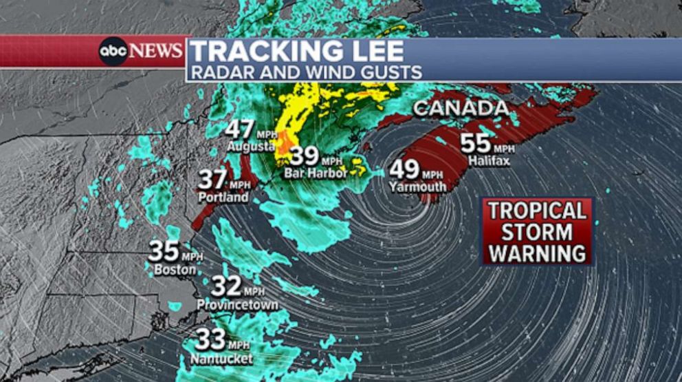
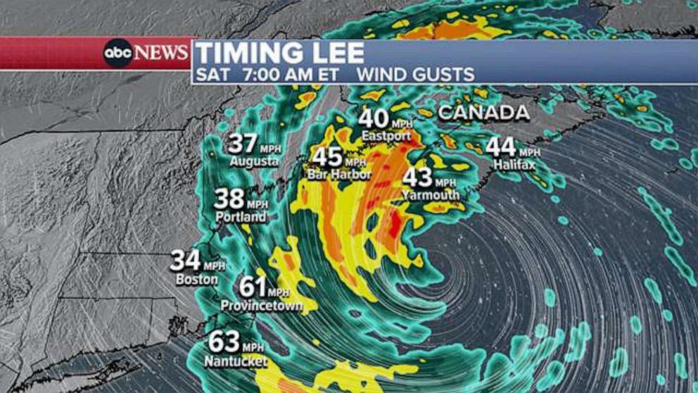
Weather conditions are improving across much of New England. Notable impacts moving forward are now focused over eastern Maine, where strong wind gusts and areas of rain will linger through this evening before it all wraps up by midnight.
A tropical storm warning remains in effect for portions of Maine, as well as across Nova Scotia and portions of New Brunswick, Canada.
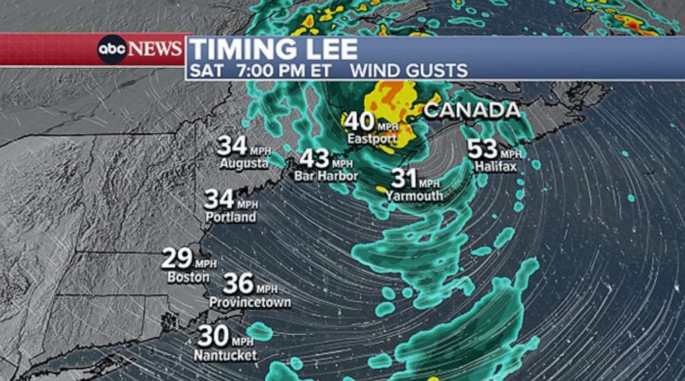
Eastern Maine and western Nova Scotia are getting hit with the brunt of the rain and wind impacts from Lee. A wind gust of 52 mph was recently reported in Bangor, Maine.
Breezy conditions will persist along the New England coast this evening and tonight. Notable impacts should be done by midnight as what's left of Lee races north.
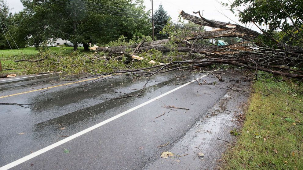
Ocean impacts will be slower to improve this weekend. Rough surf and dangerous rip currents will impact a large swath of the East Coast through this evening, then begin to diminish on Sunday.
-ABC News' Daniel Peck
More than 102,000 customers are without power in New England, including more than 93,000 in Maine, amid weather impacts from Lee, according to PowerOutage.us.
Hurricane Lee will pick up speed over the next 24 hours as it races up the East Coast.
Tropical storm warnings are in effect along the coast from Massachusetts to Maine. Coastal flood advisories and high surf advisories are also in effect.
A man installs storm shields on the windows of his grandmother’s house in Marshfield. #WCVB pic.twitter.com/tbKbX6BLPP
— David Bienick (@BienickWCVB) September 15, 2023
The rain will begin in southeastern New England Friday night, with winds strengthening overnight. Wind gusts up to 60 mph are possible in Cape Cod and Nantucket.
Lee, now a Category 1 hurricane, is forecast to weaken to a tropical storm on Saturday.
The Tropical Storm Warning covers the entire #Massachusetts coastline with strong wind, rain & coastal flooding expected.Weather conditions can change quickly. Make sure you're aware of the latest weather & safety advisories by having multiple ways to receive emergency alerts. https://t.co/mUgbvdRoEg pic.twitter.com/JotyXYqguv
— MEMA (@MassEMA) September 15, 2023
Most of the rain and wind will hit southeastern New England on Saturday and then shift toward Maine later in the day.
The rough surf will likely persist along New England's coast through Saturday night, but major flooding is not expected.
Lee is forecast to reach the shore in Canada, in western Nova Scotia or western New Brunswick, by Saturday afternoon or early evening.
By Sunday morning, the impacts from Lee will be ending in Maine and Nova Scotia.